When a powerful earthquake shook the far eastern edge of Russia in late July, it set off more than a huge movement of the EarthŌĆÖs crust. It created a breakthrough moment in how scientists watch the ocean.
For the first time, a satellite captured a complete, high-resolution view of a major tsunami as it raced across the Pacific. The images came from NASAŌĆÖs Surface Water Ocean Topography satellite, better known as SWOT, a mission built to study gentle shifts in rivers, lakes and ocean currents not roaring waves born from one of the strongest earthquakes in modern history.
Read also:┬ĀMassive earthquake off Russia triggers tsunami warnings from US to Japan
Yet on July 29, 2025, SWOT happened to be in the right place at exactly the right moment.
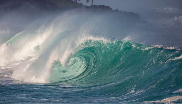
A magnitude 8.8 earthquake had just struck the Kuril Kamchatka region, the sixth most powerful recorded anywhere in the world since 1900. As the sea floor lurched upward, a tsunami spread outward at jet-speed. Then SWOT passed overhead, its instruments scanning a broad swath of open water. What it saw has changed how scientists understand these dangerous waves.

Researchers later matched the satellite readings with data from three deep ocean DART buoys. The combined picture revealed a tsunami that was far more complex than the single clean crest often shown in textbooks. Instead of one huge pulse, the wave broke into a large leading rise followed by smaller, stretched-out waves that trailed behind it across hundreds of miles.
Read also:┬ĀŌĆ£HeŌĆÖs a loser againŌĆØ ŌĆō TinubuŌĆÖs aides mock Atiku as defection tsunami hits PDP
Angel Ruiz Angulo, lead author of the study published in The Seismic Record and an oceanographer at the University of Iceland, said the moment felt transformative. ŌĆ£It is like putting on a new pair of glasses. Suddenly we are not guessing the structure of the wave. We can actually see it,ŌĆØ he said.
The satellite images showed braided patterns of energy spreading across the ocean surface, proof that large tsunamis do not travel as simple non-dispersive waves. They bend, twist and spread their energy in ways that instruments on the sea floor often miss.
Read also:Panic at Nasarawa crusade as fear of armed herders trigger stampede

The discovery was partly luck, but its implications are serious. If satellites like SWOT can detect tsunami waves early in their journey, they could strengthen warning systems that now rely mainly on seismic readings and scattered buoys. Those tools can signal that a tsunami has formed, but they cannot fully show how its energy changes once it moves away from the earthquake zone.
No technology can stop a tsunami, but understanding its shape and behaviour in real time could help save lives. A clearer picture of a wave in motion gives coastal communities a better chance to judge its size, speed and impact before it reaches land.
This rare moment, captured from hundreds of miles above the Earth, has given scientists something they have never had before: a full view of a tsunami as it forms, evolves and races across the open ocean. It is a leap forward in ocean monitoring ŌĆö and one that may strengthen the worldŌĆÖs ability to prepare for the next big wave.