Africa, the world’s second-largest continent after Asia, is home to 54 countries recognised by the United Nations and the African Union. Stretching across diverse landscapes and climates, the continent is divided into several geographic and political zones.
Many of Africa’s modern borders are a legacy of the Berlin Conference and the Scramble for Africa in the late 19th century, when European powers carved up territories with little regard for the continent’s ethnic, cultural, and social realities. As a result, today’s borders reflect historical decisions made over a century ago rather than the natural evolution of African societies.
While population and economy often dominate discussions about African nations, land area provides another lens to understand the continent’s scale. Algeria currently holds the title of the largest country by land, followed closely by the Democratic Republic of Congo (DRC) and Sudan. These nations highlight the logistical and governance challenges that come with managing vast territories, from infrastructure to resource distribution.
Africa’s borders and country sizes are not static; wars, independence movements, and political agreements have shaped, and may continue to shape, the map of the continent. Examining Africa through land area offers a unique perspective on its diversity, geography, and the daily realities of life across its expansive nations.

Currently, the three largest countries in Africa by land area are Algeria, the Democratic Republic of the Congo, and Sudan.
1. Algeria
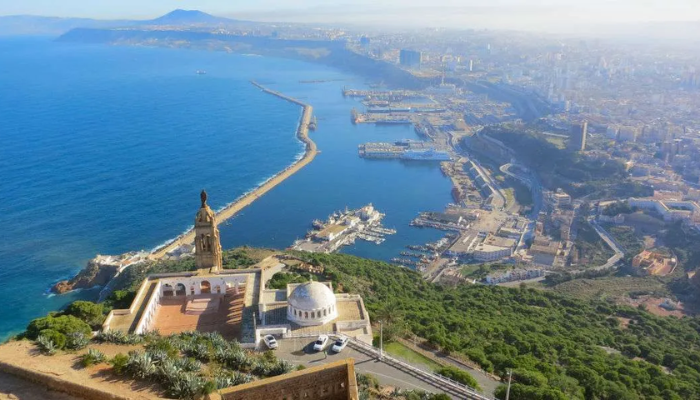
Algeria is the largest country in Africa, covering a total area of 2,381,741 square kilometres. The country has a population of 47 million people. Most of Algeria’s population lives in the northern part of the country, while the southern region stretches deep into the Sahara Desert. The capital city, Algiers, is also the largest in the country. It has a long history and is over a thousand years old. Algeria’s government, economy, and infrastructure are concentrated in the north, whereas the south remains sparsely populated.
2. Democratic Republic of the Congo (DRC)

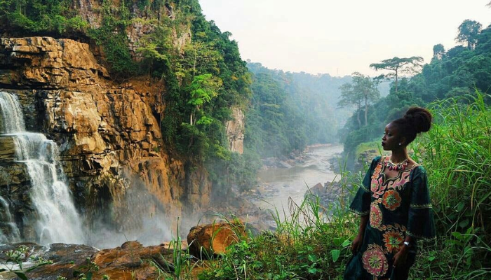
The Democratic Republic of the Congo occupies the second-largest area in Africa, covering 2,344,858 square kilometres, which represents 7.7 per cent of the continent’s land. The DRC is located on the equator and features a hot, humid, and tropical climate. Over half of the country’s land is covered by dense rainforest. The population of the DRC is approximately 109 million people. In terms of population, it ranks fourth in Africa, behind Nigeria, Ethiopia, and Egypt. The country’s geography and climate influence both agriculture and transportation, making access to certain regions challenging.
3. Sudan
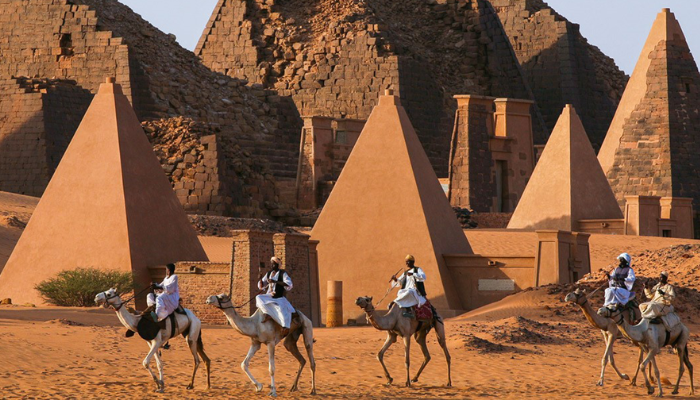
Sudan ranks third in terms of land area in Africa, covering 1,861,484 square kilometres. The country accounts for 6.2 per cent of the continent’s landmass. Sudan has a population of 50 million people, placing it eighth in Africa by population. The country became independent on 1 January 1956, but the region has a long history that includes the Kingdom of Kush, which once conquered Egypt over two thousand years ago. Until 2011, Sudan was the largest country in Africa. This changed when South Sudan gained independence after a civil war. The separation of South Sudan significantly reduced Sudan’s land area but left it among the continent’s largest countries.