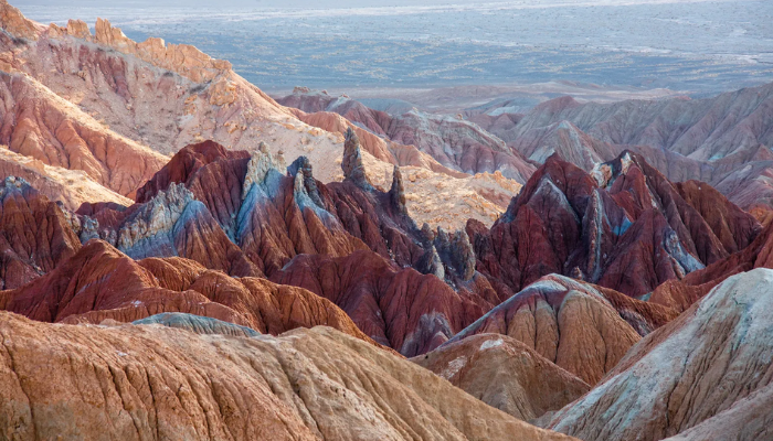
Deserts, defined by low rainfall and arid climates, cover nearly one-third of the planetŌĆÖs land surface, shaping both geography and ways of life across regions. While rainforests and mountains often capture attention, deserts, ranging from scorching sands to frigid stone plains, support diverse ecosystems, Indigenous cultures, and emerging renewable energy projects.
According to the World Atlas of Desertification (WAD), true deserts, hyper-arid zones, account for around 6.6% of EarthŌĆÖs land, while over 40% falls under broader drylands. This analysis focuses on countries with the largest expanses of true desert, using ecological classifications and satellite mapping data from the WAD, UNEP-GRID, and NASA Earth Observations.
Read also: 9 places in the world where rain is scarce
The list highlights nations with significant desert coverage, including those hosting portions of major deserts like the Sahara, Arabian, and Gobi. National geospatial reports and climate zone maps further refine the desert boundaries, identifying where these vast, windswept regions lie within and across national borders

According to Cond├® Nast Traveller, here are the top 10 countries with the largest desert areas in the world in square kilometres (sq km)
Algeria: 1.5 million sq km
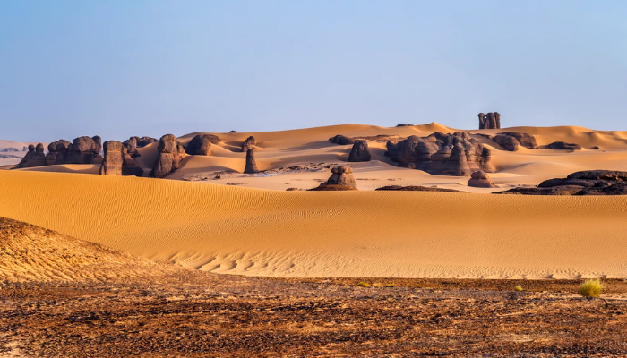
Algeria contains the largest portion of the Sahara Desert, with desert land covering more than 80% of its territory. This makes it the country with the largest desert area globally, spanning over 1.5 million square kilometres. The landscape includes sand dunes, rocky plateaus, and salt flats. Despite the climate, desert towns such as Tamanrasset and communities in the MŌĆÖzab Valley continue to exist and adapt to the terrain.
Saudi Arabia: 1.3 million sq km
Saudi ArabiaŌĆÖs landmass is dominated by the Arabian Desert, which covers about 95% of the country. The ŌĆ£Empty QuarterŌĆØ, or RubŌĆÖ al Khali, is the worldŌĆÖs largest continuous sand desert and forms a major part of this area. The desert features include dune fields, gravel plains, and escarpments. These regions hold cultural significance and are now also part of the countryŌĆÖs renewable energy development, especially in solar and wind power.

Read also:┬ĀTop 10 countries where workers are thriving mostŌĆō Study
Libya: 1.2 million sq km
Libya has one of the driest environments on Earth, with around 90% of the country covered by desert. The Libyan Desert, part of the wider Sahara, spans about 1.2 million square kilometres. Some areas experience no rainfall for decades. Despite this, archaeological evidence such as rock art and cave paintings in the Acacus Mountains reveals earlier periods of human presence and movement.
Australia: 1 million sq km
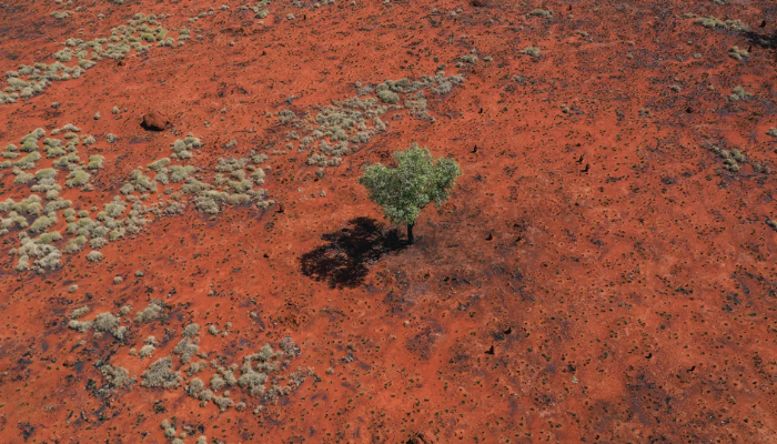
AustraliaŌĆÖs deserts are spread across the central and western regions, including the Great Victoria, Simpson, and Gibson Deserts. Together, they cover about one million square kilometres, or 18% of the countryŌĆÖs total land area. These deserts form part of the Outback and consist of shrublands, dunes, and red plains. They are also home to native species and ecosystems that respond to the rare rainfall in the region.
Read also:┬ĀTop 10 African countries with the highest worker stress rate
Sudan: 800,000 sq km
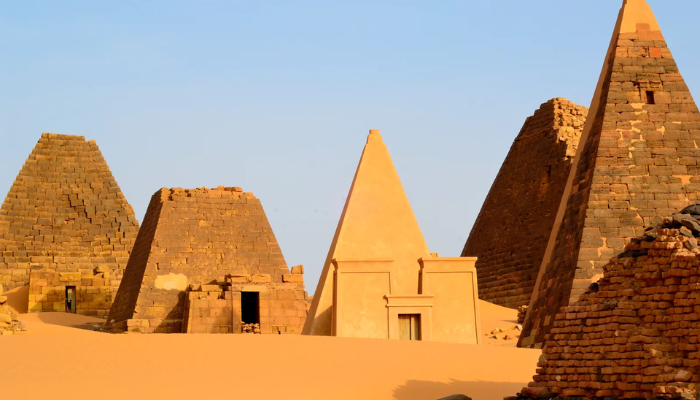
Sudan hosts over 800,000 square kilometres of desert, primarily in the northern parts of the country. The Bayuda and Nubian deserts are key regions, known for their volcanic fields, gravel plains, and historical trade routes. While the area is arid, seasonal water channels known as wadis, along with the Nile River, support limited agriculture and human settlement on the edges of the desert zones.
China: 700,000 sq km
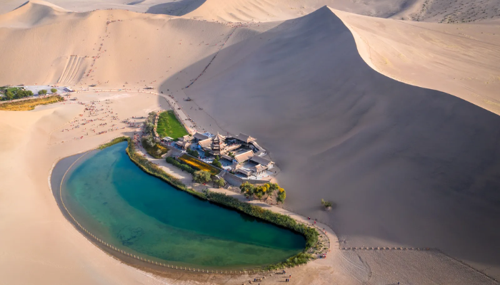
ChinaŌĆÖs desert landscape includes the Gobi and Taklamakan Deserts, which together cover over 700,000 square kilometres. The Gobi Desert stretches into Mongolia and is a cold desert with rocky and gravel-filled plains. The Taklamakan, located in the Xinjiang region, is one of the most difficult sand deserts to cross, known for its harsh conditions and shifting dunes.
Read also:┬Ā10 countries in Africa with the lowest worker stress rate
Niger: 700,000 sq km
NigerŌĆÖs desert territory extends over two-thirds of the country, covering more than 700,000 square kilometres. The T├®n├®r├® Desert, in the eastern region, is part of the central Sahara. It is marked by sand dunes, rock structures shaped by wind, and low vegetation. The area is remote but remains significant for trans-Saharan routes and desert exploration.
Mongolia: 500,000 sq km
The Gobi Desert dominates MongoliaŌĆÖs southern region, making up more than 500,000 square kilometres of the country. This desert differs from others in that it features cold temperatures and dry steppes rather than only sandy areas. Wildlife in the Gobi includes species such as the wild Bactrian camel and the snow leopard, both adapted to the harsh climate.
Read also:┬ĀTop 10 countries attracting global relocation
United States: 500,000 sq km
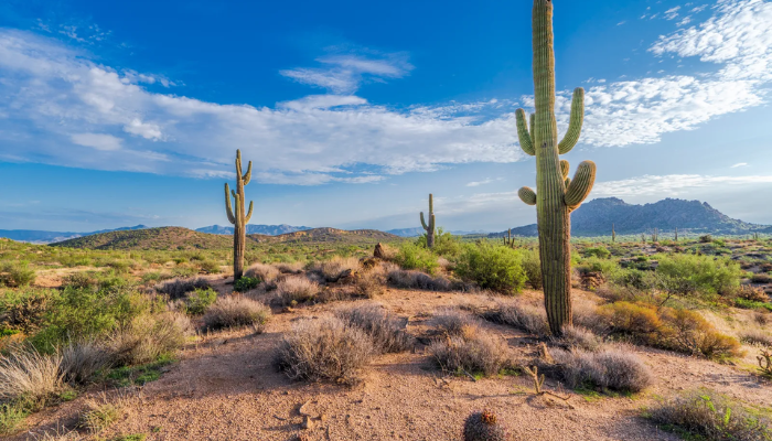
The United States contains four major desert regions: the Mojave, Sonoran, Chihuahuan, and Great Basin deserts. These areas span over 500,000 square kilometres, mostly in the Southwest. The deserts include features such as cactus fields, salt flats, and elevated plateaus. States such as Arizona, Nevada, New Mexico, California, and Utah contain the largest shares of desert land.
Iran: 300,000 sq km
IranŌĆÖs deserts include the Dasht-e Kavir and Dasht-e Lut, covering over 300,000 square kilometres. These deserts consist of salt flats, rocky plains, and large dune systems. The Dasht-e Lut has recorded some of the highest ground temperatures on the planet. Wind erosion continues to shape the landscape, and human activity in these regions remains minimal due to the extreme conditions.